News
Massive Storm Threatens Floods, Tornadoes, and Blizzards Across U.S.
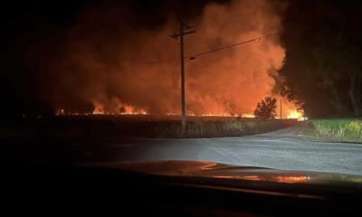
LOS ANGELES, California — A massive, atmospheric river-fueled storm that hit the West Coast on Wednesday is threatening Southern California with severe flooding, mudslides, and debris flows. Evacuations have already been issued in the Los Angeles area as the storm moves east, posing risks of wildfires, severe thunderstorms, tornadoes, and blizzard conditions for millions across the central and eastern United States.
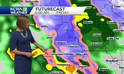
The storm system moved into California early Wednesday, bringing heavy rain and snowfall to the Pacific Northwest and Northern California. Rain began early Wednesday, with Southern California expected to face heavy rainfall and flash flood risks by late Thursday. The Weather Prediction Center has placed a level 2 of 4 risk of flooding for areas including Santa Barbara and Los Angeles, particularly in regions recently impacted by wildfires.
“Anyone in or near burn areas should complete pre-storm preparations today before the heavy rains begin tonight,” warned the National Weather Service in Los Angeles.
Following the direction of California Governor Gavin Newsom, over 400 personnel have been deployed statewide to prepare for the storm’s impacts. Evacuation orders affecting approximately 120 homes near the Palisades burn scar have been issued, as well as warnings for more than 1,700 residents living close to the Eaton Fire burn scar.
Debris flow warnings were released yesterday for various regions across Los Angeles County due to heightened risks associated with the burn scars. In Sierra Madre, residents were seen stocking up on sandbags in anticipation of the storm.
Effective at noon on Wednesday, a section of the Pacific Coast Highway from eastern Malibu to just east of Will Rogers Beach has been closed in anticipation of flooding and mudslide risks.
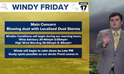
As the storm progresses eastward, it will strengthen significantly, bringing widespread wind gusts of 40 to 50 mph across parts of the Rockies, with higher gusts in mountainous areas likely. This will generate hazardous travel conditions as well as an enhanced risk of wildfires across an 800-mile stretch of the central U.S., from western Texas up to Nebraska.
According to the Storm Prediction Center, areas from New Mexico to Kansas are currently under a level 2 of 3 fire weather risk, heightening the concerns for potential fire outbreaks in the region.
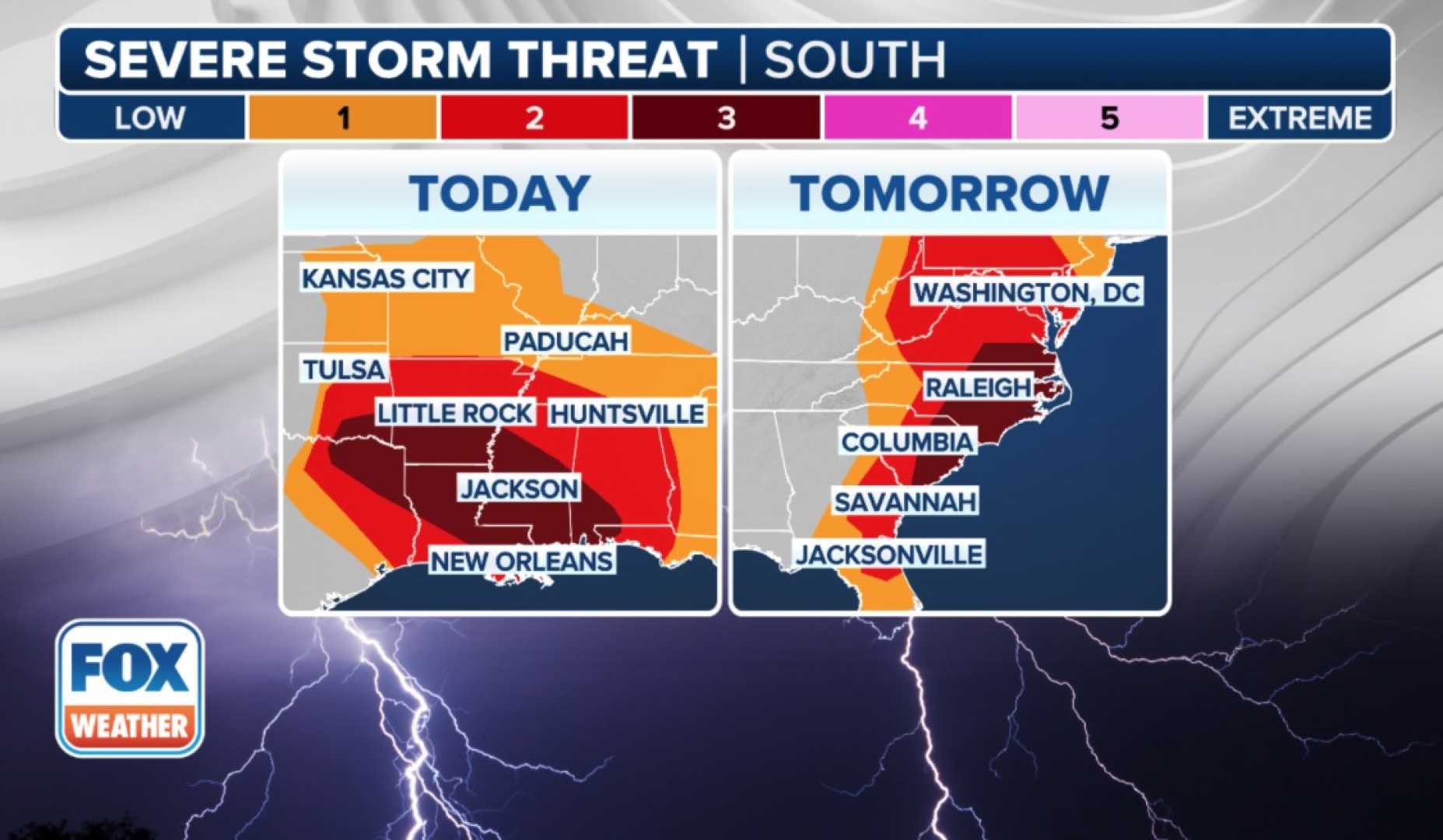
The storm is predicted to unleash severe thunderstorms by late Thursday evening across the Mississippi Valley as a cold front collides with warm, moist air from the Gulf of Mexico. A serious level 3 of 5 risk of severe storms has been issued for regions from Mississippi to Illinois, forecasting winds exceeding 75 mph and the possibility of EF2 or higher tornadoes.
Nighttime tornadoes, which are statistically more deadly due to visibility issues, could also occur as the storm system progresses into the evenings. Severe thunderstorms could expand to cover over 900 miles of the Mississippi Valley, affecting areas from Louisiana to Minnesota.
As the storm continues its path into the eastern U.S. over the weekend, blizzard conditions, heavy rainfall, and severe thunderstorms are projected, impacting travel and potentially causing flash flooding from Mississippi to northern Georgia and north into Kentucky.
Authorities urge communities to stay alert and prepared for rapid changes in weather and potential evacuation orders. The National Weather Service advises those in vulnerable areas to stay updated on alerts from local officials.
This storm arrives shortly after another severe system caused significant disruptions across various states last week. As conditions evolve, officials continue to monitor the storm’s development and its potential impacts.